Severe Thunderstorm Warning Issued for Northern Mississippi
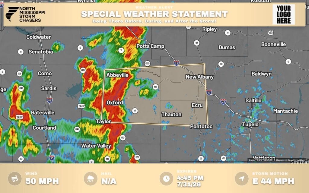
A weather alert has been issued for parts of northern Mississippi as a strong thunderstorm moves through the region. Doppler radar detected the storm near Oxford, which is moving east at 45 miles per hour, according to the National Weather Service.
The storm is producing wind gusts up to 50 mph. These gusts could cause minor damage by knocking down tree limbs and blowing around unsecured objects, meteorologists said.
The affected areas include Oxford, New Albany, Pontotoc, Holly Springs National Forest, Ecru, Cambridge, Etta, Denmark, Pinedale, Thaxton, Abbeville, Taylor, Toccopola, Shari, Hortontown, Poolville, Keel, Esperanza, Cherry Creek, and Old Myrtle. The storm also impacts Interstate 22 between mile markers 55 and 67.
The weather service issued the special weather statement at 4:08 p.m. and expected it to expire by 4:45 p.m. A radar map with more details is available at greenewx.com.
Source: Original Article
