Severe thunderstorms, cold front to impact Tennessee area this week
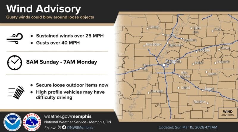
A busy weather day is forecast for the Tennessee region, according to the National Weather Service in Memphis. A Wind Advisory will take effect at 8 a.m. for gusts up to 45 mph, not linked to thunderstorms, authorities said.
Starting as early as 3 p.m., a line of strong to severe thunderstorms is expected to approach from the west. The primary threat is damaging wind gusts, but forecasters warn that tornadoes could develop quickly within the line. Any tornado that forms could be strong, officials added.
The storms are associated with a cold front that will usher in colder air behind it. Temperatures will plunge Monday and Tuesday mornings, with lows expected to be well below normal. A Freeze Warning is in effect for Monday, and a Freeze Watch covers the area for Tuesday.
Residents are advised to stay vigilant and monitor weather updates. A full briefing with additional information is available at this link.
Source: Original Article