Mississippi Elevated to Enhanced Risk for Severe Weather Sunday Night
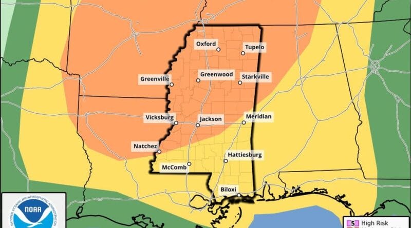
The Storm Prediction Center has upgraded much of Mississippi to an enhanced risk level for severe weather, citing a strong storm system moving across the region Sunday evening through early Monday. The upgrade places the area at a Level 3 of 5 on the severe weather risk scale.
A line of severe thunderstorms is expected to develop to the west and move into Mississippi Sunday evening and into the overnight hours. Forecasters say tornadoes are likely to remain generally short-lived, or “spin-up,” and damaging wind gusts are the primary concern. Large hail could also occur with storms that develop ahead of the main line.
Forecast guidance indicates the highest tornado threat may occur late Sunday evening into early Monday morning, as instability and wind shear increase across the region. The timing is estimated to be late Sunday evening in western Mississippi, near midnight in the Jackson area, and overnight into early Monday morning in eastern Mississippi.
The storms are expected to organize into a squall line capable of producing damaging winds and quick-forming tornadoes. Residents are advised to review their severe weather safety plans, ensure they have multiple warning sources, and stay updated with the Mississippi Weather Network as new forecast data becomes available.
Officials emphasize the importance of staying weather-aware during this period.
Source: Original Article