Satellite Image Shows Formation of Cloud Streets Over Northeast Mississippi and Northwest Alabama
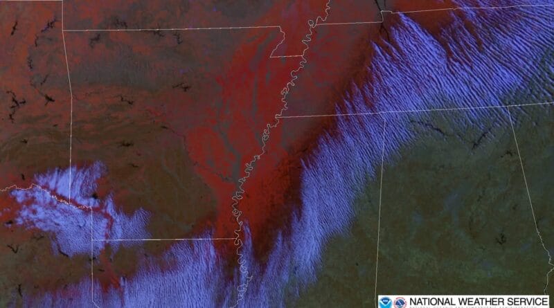
A still image from the GOES Day Snow-Fog imagery at 21:21 UTC (3:21 PM CST) reveals the development of convective cloud rolls, also known as “cloud streets,” in northeast Mississippi and northwest Alabama.
The image highlights color-coded features: dark red indicates ice, while light red and orange represent snow. These cloud formations form as cold air moves off the ice pack onto warmer land, prompting the development of organized cloud patterns.
More information about GOES Day-Fog imagery is available at this link. Details about cloud streets can be found at this resource.
Source: Original Article